
Evidence behind the guide
Sources &
photo credits
Start with the source, not just the summary. These official references support the factual descriptions in the guide. Our planning frameworks are editorial suggestions, not official itineraries.
Sources checked on October 11, 2026. Visitor details can change after that check. Exact URLs are displayed as unlinked text in this version; copy a URL to consult the responsible source. We have not activated commercial, affiliate or referral links.
We paraphrase official descriptions and do not claim agency affiliation, endorsement or ownership of original U.S. Government works. A source check is not a promise that a place, activity or facility is available on your visit.
Everglades National Park
Overview of wetland, forest and marine habitats; establishment in 1947. No acreage copied into visible copy.
https://www.nps.gov/ever/index.htmChecked October 11, 2026 · National Park Service
Habitats and Plant Communities
Small changes in elevation influence habitat; hardwood hammock, pineland, prairie, slough, cypress, coastal lowland, mangrove and marine/estuarine settings.
https://www.nps.gov/ever/learn/nature/habitats.htmChecked October 11, 2026 · National Park Service
Plan Your Visit to Everglades National Park
Planning categories, visitor centers, things to do, accessibility and season-dependent considerations. No hours, price or closure copied.
https://www.nps.gov/ever/planyourvisit/index.htmChecked October 11, 2026 · National Park Service
Where is Everglades National Park?
Three entrance areas: Homestead, Shark Valley/Miami and Everglades City; not interconnected. No travel-time guarantee.
https://www.nps.gov/ever/planyourvisit/directions.htmChecked October 11, 2026 · National Park Service
Canaveral National Seashore
Barrier island, dunes, coastal hammocks and Mosquito Lagoon; Timucua shell mounds. No claim of present access.
https://www.nps.gov/cana/index.htmChecked October 11, 2026 · National Park Service
Gulf Islands National Seashore
Florida and Mississippi areas, beaches, marshes and historic landscapes. Never imply Mississippi images are Florida.
https://www.nps.gov/guis/index.htmChecked October 11, 2026 · National Park Service
Dry Tortugas National Park
Remote islands west of Key West, predominantly open water, boat or seaplane access, Fort Jefferson on Garden Key.
https://www.nps.gov/drto/index.htmChecked October 11, 2026 · National Park Service
Castillo de San Marcos National Monument
Spanish-built masonry fort in St. Augustine and cultural intersections; photograph credit.
https://www.nps.gov/casa/index.htmChecked October 11, 2026 · National Park Service
Stories: Castillo de San Marcos
Coquina construction, changes of control and Native American incarceration. No complete-history claim.
https://www.nps.gov/casa/learn/historyculture/stories.htmChecked October 11, 2026 · National Park Service
Images for Publication: Everglades
Explicit public-domain image collection and no implied NPS endorsement.
https://www.nps.gov/ever/learn/photosmultimedia/imagesforpublication.htmChecked October 11, 2026 · National Park Service
Everglades Habitat Images
Linked image membership and National Park Service Photo credit for Florida Bay, Freshwater Prairie and Mangroves.
https://www.nps.gov/ever/learn/news/evergladeshabitatimages.htmChecked October 11, 2026 · National Park Service
NPS Disclaimer: Ownership
NPS-created materials generally public domain unless otherwise indicated; third-party exceptions and trademark restrictions retained.
https://www.nps.gov/aboutus/disclaimer.htmChecked October 11, 2026 · National Park Service
Canaveral official image records
Exact Apollo Beach photo path, title, alt text and NPS Photo Lord credit. No different gallery image substituted.
https://www.nps.gov/cana/structured_data_cana.jsonChecked October 11, 2026 · National Park Service
Castillo official image records
Exact Castillo Drawbridge photo path, title, alt text and NPS Photo credit.
https://www.nps.gov/casa/structured_data_casa.jsonChecked October 11, 2026 · National Park Service
Photographs, one source at a time
The three Everglades habitat photographs are linked from the park's publication-image collection, which identifies those images as public domain and prohibits implied endorsement. The Canaveral and Castillo photographs have exact NPS photo credits in the parks' official image records; the NPS ownership policy applies to NPS-created material unless otherwise indicated. No different or uncredited image has been substituted.
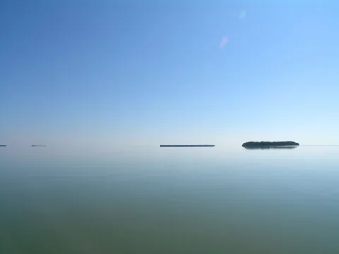
Florida Bay, Everglades National Park
Credit: National Park Service photo. Resized for responsive delivery; the homepage Florida Bay image is displayed in a landscape crop. Other photographs retain their full source proportions.
Image-specific source record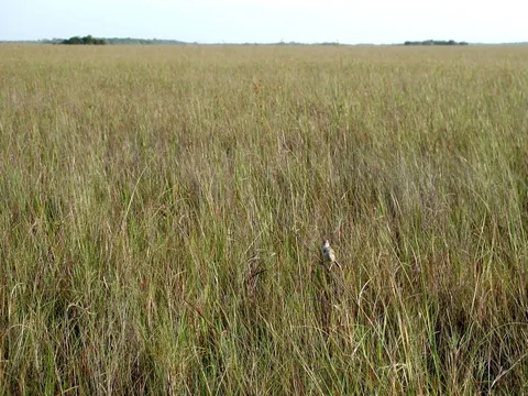
Freshwater prairie, Everglades National Park
Credit: National Park Service photo. Resized for responsive delivery; the homepage Florida Bay image is displayed in a landscape crop. Other photographs retain their full source proportions.
Image-specific source record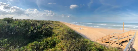
Apollo Beach, Canaveral National Seashore
Credit: NPS Photo Lord. Resized for responsive delivery; the homepage Florida Bay image is displayed in a landscape crop. Other photographs retain their full source proportions.
Image-specific source record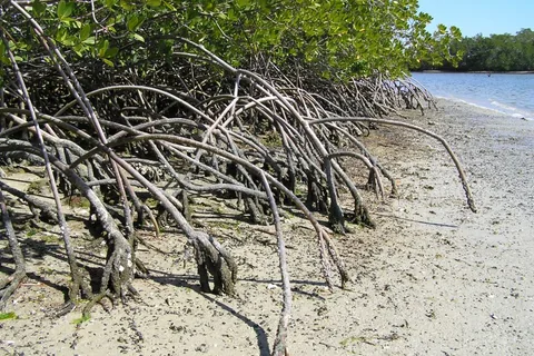
Mangroves, Everglades National Park
Credit: National Park Service photo. Resized for responsive delivery; the homepage Florida Bay image is displayed in a landscape crop. Other photographs retain their full source proportions.
Image-specific source record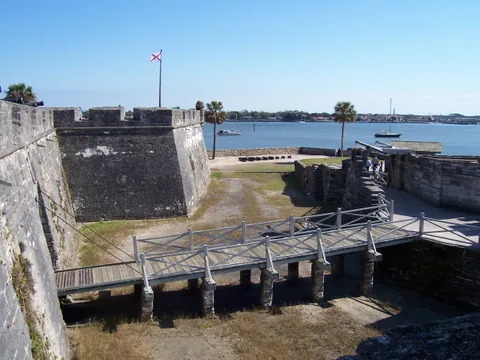
Drawbridge, Castillo de San Marcos
Credit: NPS Photo. Resized for responsive delivery; the homepage Florida Bay image is displayed in a landscape crop. Other photographs retain their full source proportions.
Image-specific source recordNo claim to original U.S. Government works. The NPS policy also identifies third-party exceptions and protects official insignia. Our original shoreline mark is not an NPS or government symbol. These documentary photographs do not establish present conditions.